
Las Vegas Springs
The Las Vegas Springs Preserve opened on June 8, 2007.
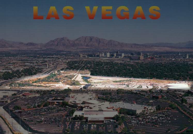
This picture is a derivative of a postcard by Philip Mattes. Fair Use.
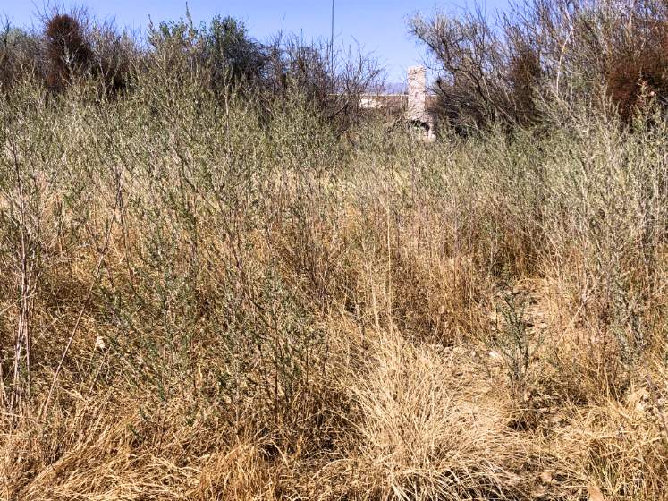
"The grassy area that slopes down from the caretaker's chimney may be the last remnant of the original meadows for which Las Vegas was named. Spanish explorers and the New Mexican trading caravans that began crossing the Valley in the 1830s called this place by several names, including Las Vegas, Ojo del Gaetan, and Ojo de Quintana." (Springs Preserve)
A prehistoric Ancestral Puebloan village of pithouses dating back to A.D. 700 was discovered in this area.
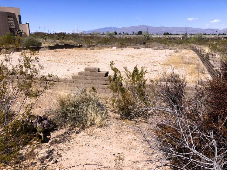
Two adobe structures found at the Springs Preserve date back to the late 1800s.
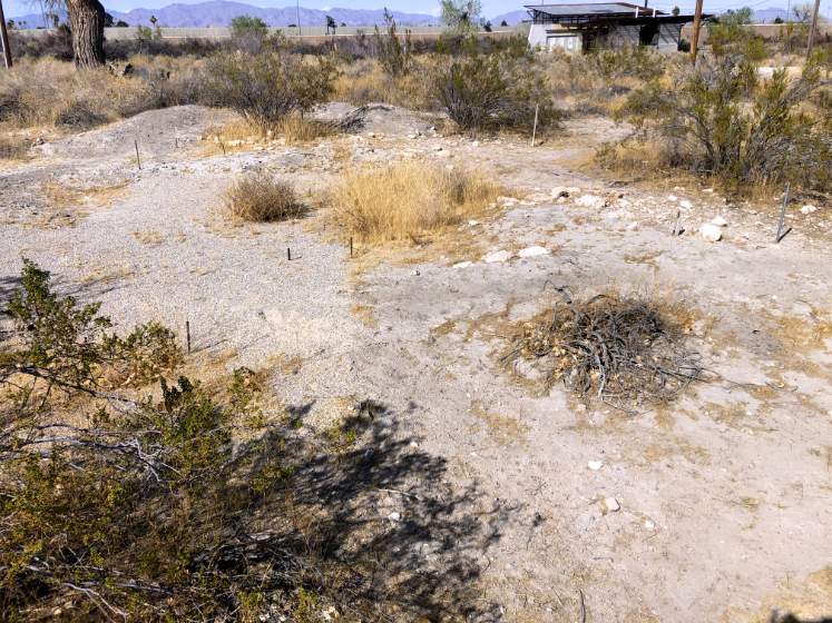
A dugout dating back to 1870 was located at this location.
Springhouses were built between 1911 and 1917.
Twenty feet above historic spring mound Well No. 2; drilled in 1936.
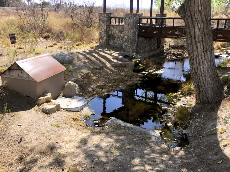
The Las Vegas Creek.
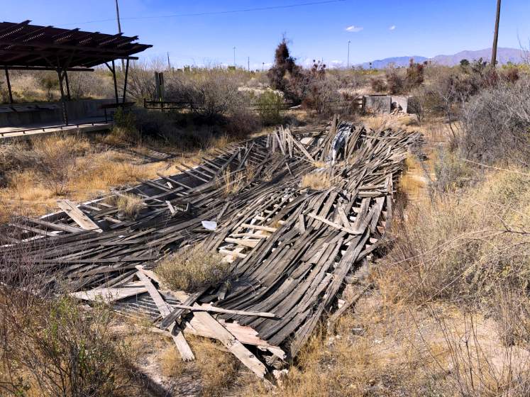
The ruins of the Big Spring springhouse.
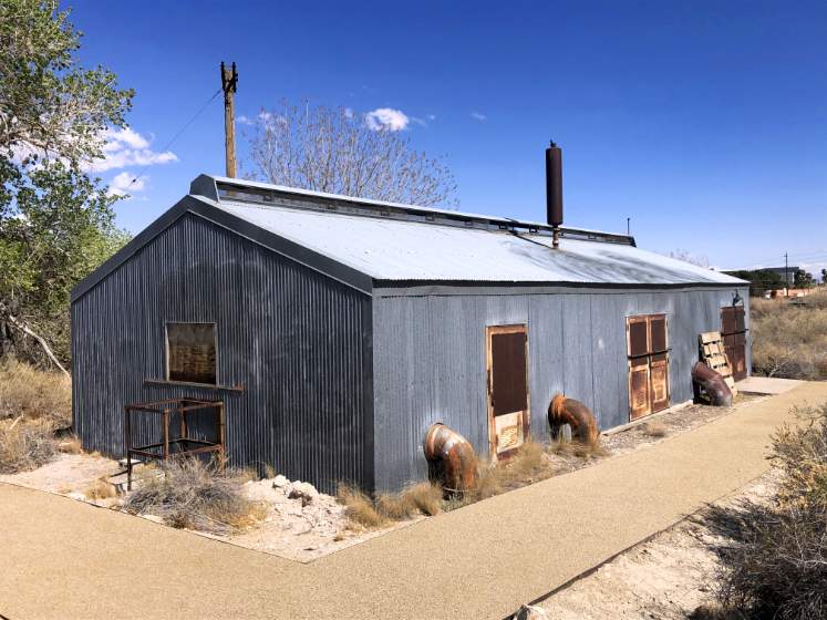
The pump station was completed in 1929.
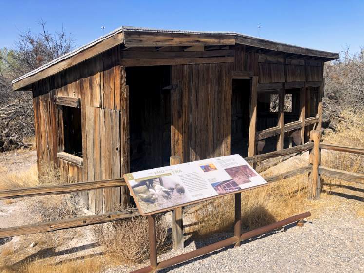
The caretaker's shanty served from the 1920s to the 1950s.
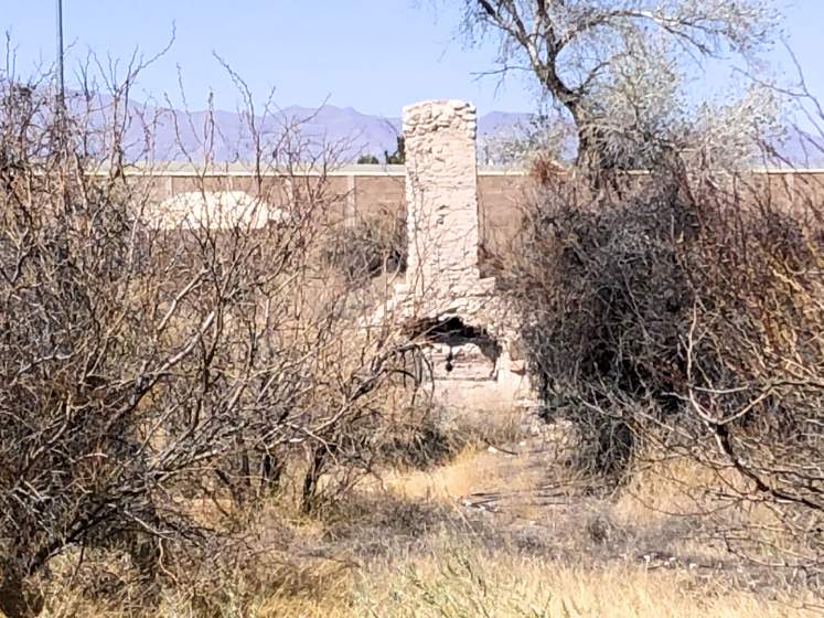
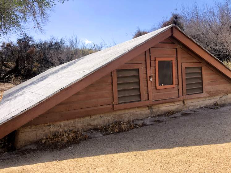
The chimney was part of a Boy Scout cabin built in the 1930s.
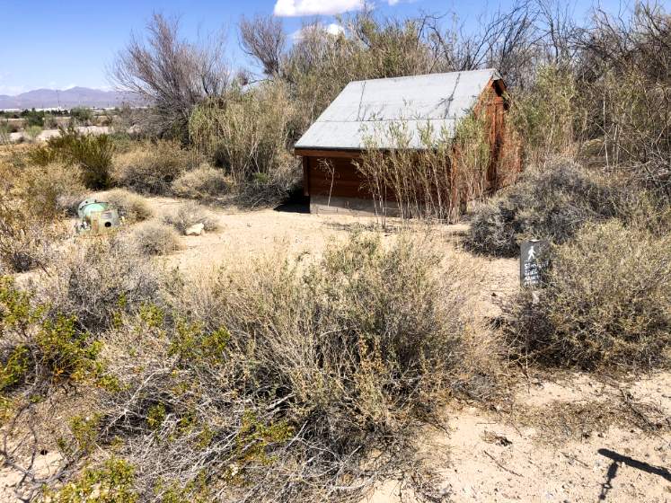
The chicken coop was built in the 1920s.
The abandoned caretaker's barn was crushed by a fallen tree limb.
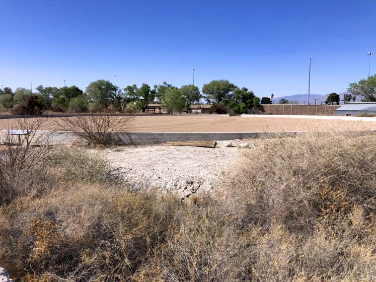
The was the location of the 1929 Reservoir No. 1.
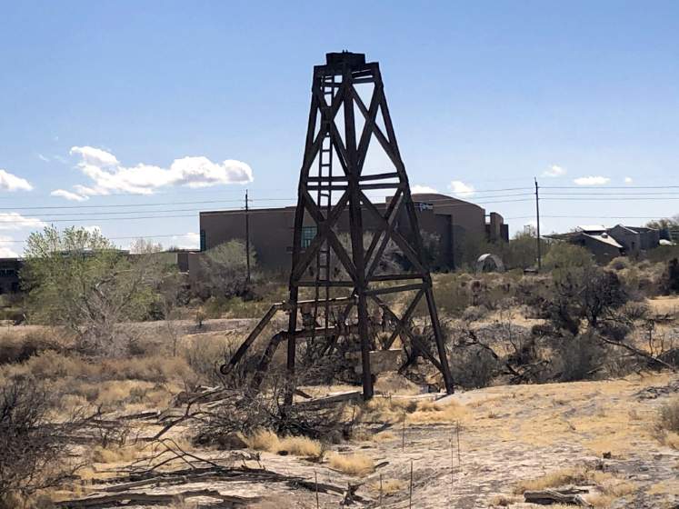
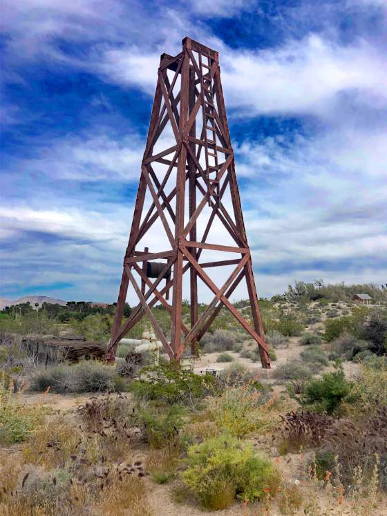
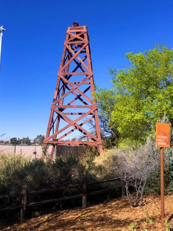
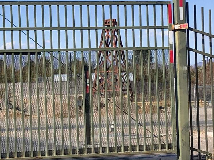
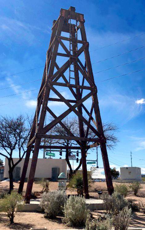
Old Well Tower #10. Built in 1942. Located at the intersection of West Charleston Boulevard and South Valley View Boulevard.
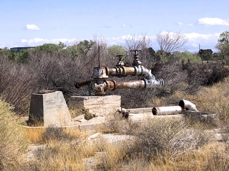
Well #5.
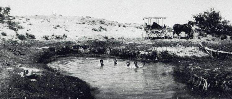
Photograph of men swimming in Big Spring, Las Vegas, Nevada, 1905-1910. Elbert Edwards Photo Collection. UNLV Libraries Special Collections & Archives. Original cropped by The Historic Las Vegas Project.
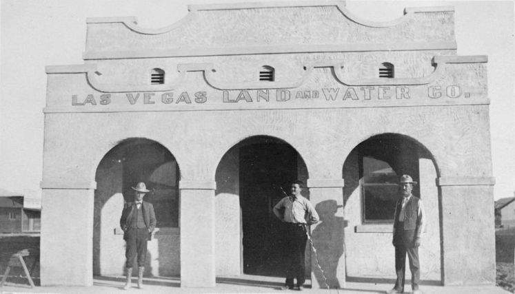
Film transparency of Las Vegas Land and Water Company, circa early 1900s. Squires Collection. UNLV Libraries Special Collections & Archives.
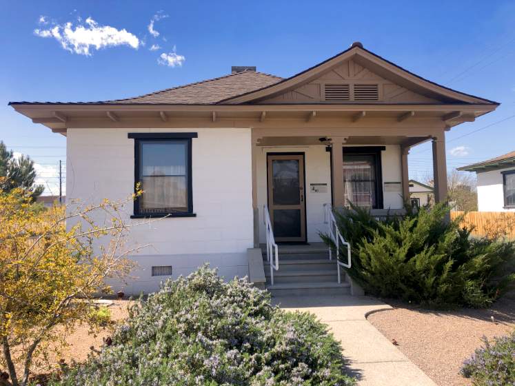
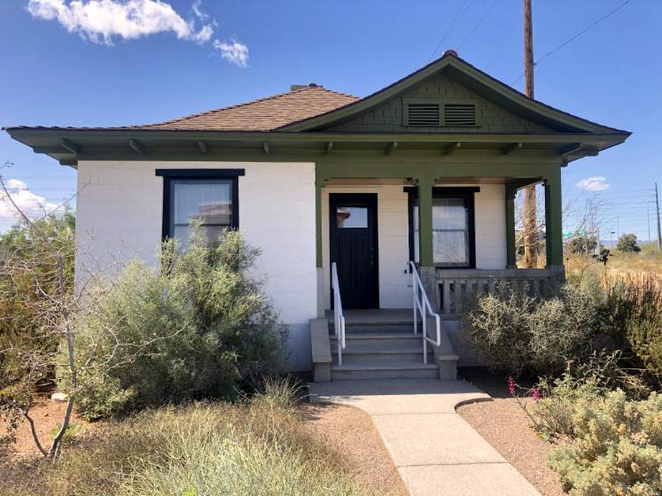
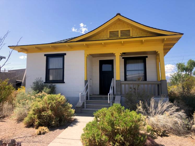
Railroad Cottages
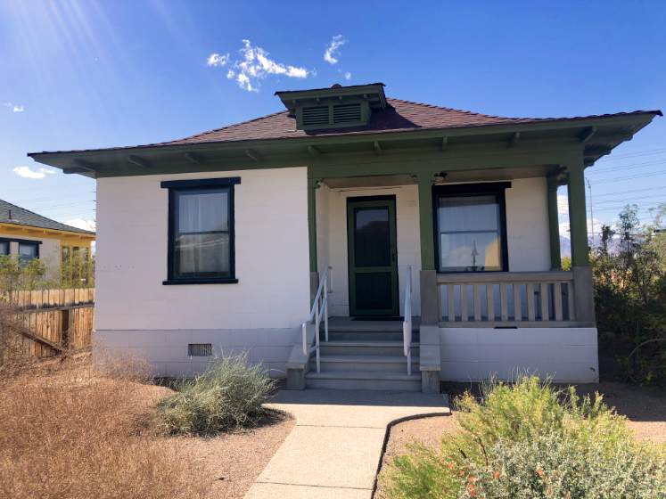
The historic railroad cottages pictured below were originally located in the area of South Casino Center Boulevard and East Bonneville Avenue in Las Vegas, Nevada. The cottage pictured above was originally located at 621 South Casino Center Drive, Las Vegas, Nevada. It is listed on the National Register of Historic Places as a U.S. Historic District Contributing Property (Railroad Cottage District: 1987).
"The famous Las Vegas Springs rose from the desert floor here, sending two streams of water across the valley to nurture the native grasses, and create lush meadows in the valley near Sunrise Mountain. The natural oasis of meadow and mesquite forest was the winter homeland of Southern Paiutes, who often spent the summers in the Charleston Mountains. An unknown Spanish-speaking sojourner, named this place “Las Vegas” meaning “The Meadows”.
Antonio Armijo led a trading party from Santa Fe to California in 1829-30, traversing part of the Las Vegas Valley. One branch off the main Old Spanish Trail included the Springs as a resting spot. On one of his western exploration trips, John C. Fremont camped here on May 3, 1844 and was the first to officially put Las Vegas on the map.
Because of artesian water here, Mormons established the Las Vegas Mission and Fort in 1855 a few miles east of the Springs. The San Pedro, Los Angeles, and Salt Lake Railroad Company acquired water rights and land, with which it created the City of Las Vegas in 1905."
(Nevada Historical Marker 40)
"The San Pedro, Salt Lake and Los Angeles Railroad bought Helen Stewart's Las Vegas Ranch in 1902, giving it control of the Las Vegas Springs and the water supply needed for the creation of Las Vegas in 1905. The railroad's subsidiary, the Las Vegas Land and Water Company, regulated water use. Early delivery to residents was inconsistent, often due to the use of redwood pipes. The valley was dotted with artesian wells; unfortunately many were unmonitored, contributing to the depletion of the water table. The building of Hoover Dam and the formation of Lake Mead in the 1930s eventually provided a permanent, stable water supply for the valley. The Las Vegas Land and Water company sold the facilities and rights to the Las Vegas Valley Water District in 1954. In the mid-1950s, Lake Mead water began to flow into Las Vegas. Water has been a key factor in the evolution of Las Vegas and will continue to play a critical role in the sustainability of our community."
(Las Vegas Centennial Commission)
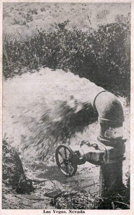
"Bubbling artesian springs flowed here until they were exhausted in the middle of the 20th century, over-pumped to serve the city's growing population.
These springs and the creek they created gave life to the center of the valley. They erupted about 8000 years B.P. (before present). People came to the valley because of the reliable water and the plants and animals it supported. The springs allowed the Anasazi Indians and later the Paiute Indians to irrigate small gardens. Between 1829 and 1848, the natural grasslands watered by the creek made this an important stop for New Mexican mule caravans on their way to California. These Spanish-speaking traders named the campsite "Las Vegas" (the meadows).
Anglos began using the water in 1855, when the Mormons opened a mission about three miles east of the Springs. Later, pioneers John Howell and James B. Wilson developed a ranch at the Springs site. Howell was the first black man to settle in the Las Vegas Valley. He arrived in 1870, married a Paiute woman and ran cattle with Wilson from 1872-1874, when Wilson left the valley. In 1876, Howell sold his "Spring Ranch." In 1902, the springs, creek and land were sold to the San Pedro, Los Angeles and Salt Lake Railroad, which discontinued ranching at the springs so the water could be used to serve Las Vegas."
(Las Vegas Pioneer Trail Marker 1)
"From within this area flowing artesian springs and wells provided the lifeblood to the valley and it settlers.
This abundant supply of water has been the most important asset in the establishment, development and growth of the city of Las Vegas and the Las Vegas Valley."
(City of Las Vegas Diamond Jubilee)
Listed on the the National Register of Historic Places in 1978 (Address Restricted).
Listed on the Nevada State Register of Historic Places in 1981.
Located at 333 South Valley Boulevard, Las Vegas, Nevada.