
Las Vegas High School Neighborhood District
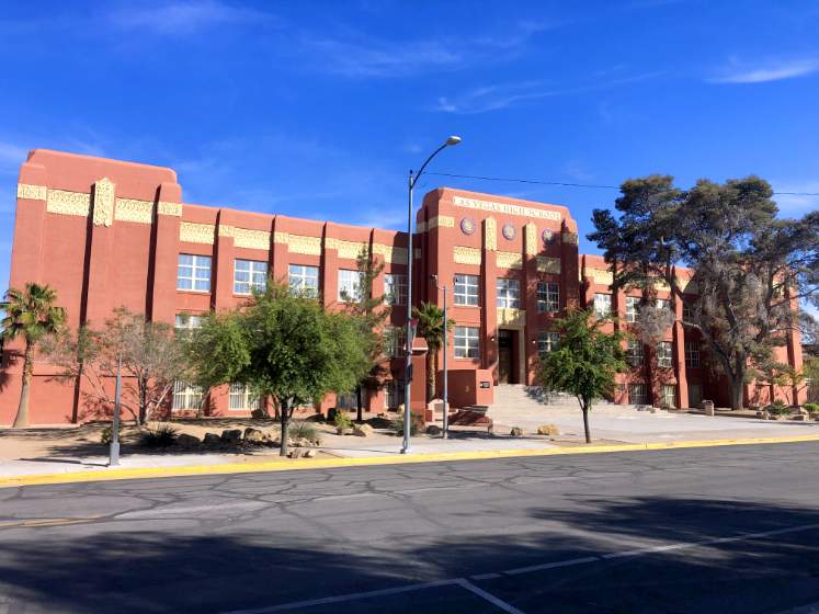
"As the population of Las Vegas increased throughout the 1920s and the construction of Hoover Dam was assured, many saw the need for a new high school. Principal Maude Frazier overcame public criticism that the location was "too far out of town." Despite opposition, she led a successful bond measure to pay for the school. This noteworthy example of Art Deco architecture was completed in 1930 for $350,000. The new school reflected the growth and maturation of Las Vegas. The Las Vegas Academy now occupies the Las Vegas High School. The building is listed on the local and National Register of Historic Places." (Las Vegas Centennial Commission)
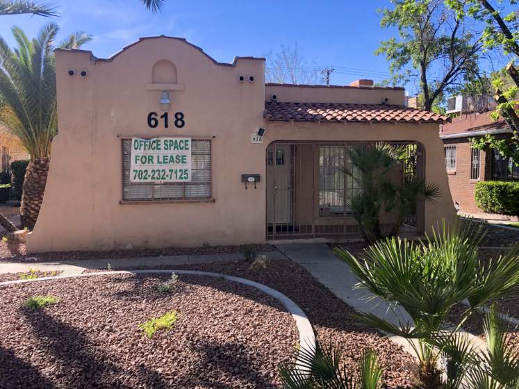
"Mission Revival, 1930. Harry Allen, pioneer Las Vegas banker, civic leader and later president of Nevada Power, lived here until the 1950s." (Las Vegas Centennial Commission)
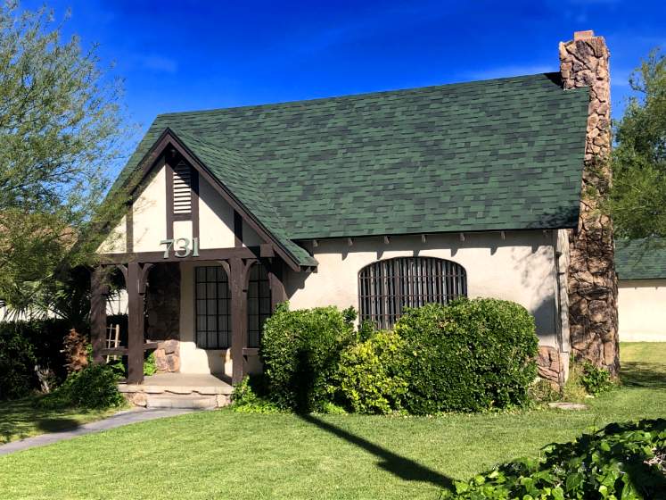
"Tudor Revival, 1936. This house was built for businessman Ralph Purdy at a cost of $3,600. He owned a local Texaco station." (Las Vegas Centennial Commission)
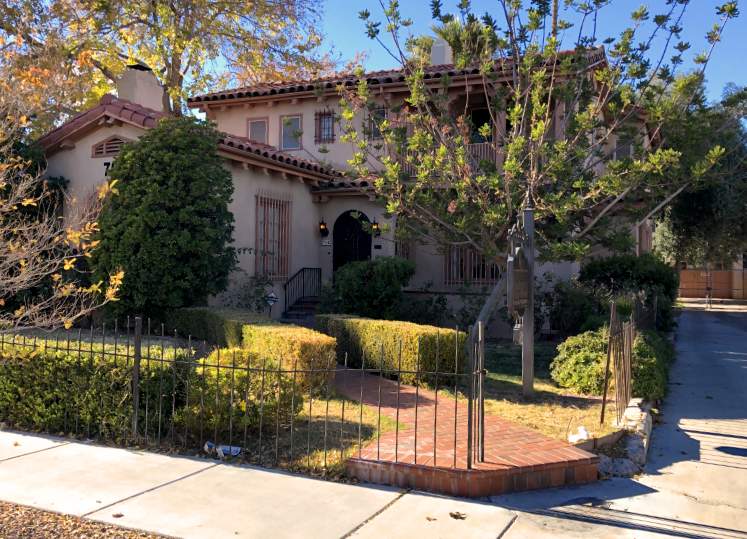
"Spanish Colonial Revival, 1930. Designed by A.L. Worswick and built for $10,000, this house was owned by district Judge A.S. Henderson, who was also an Assemblyman, State Senator and City Attorney." (Las Vegas Centennial Commission)
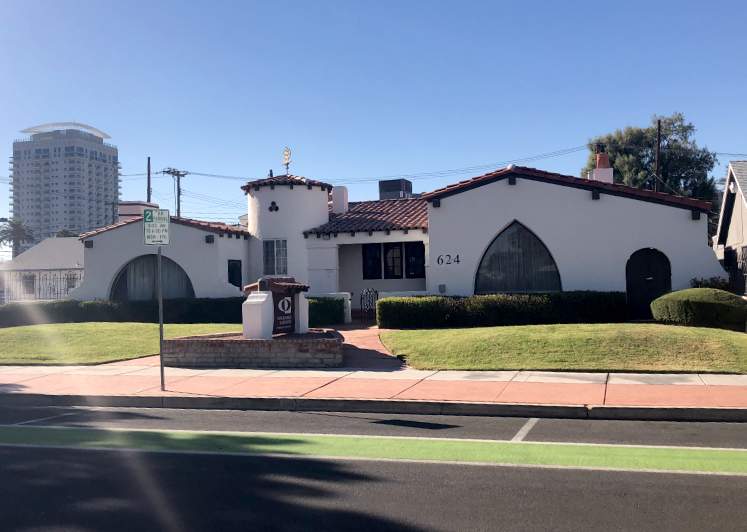
"Spanish 1932. Prominent dentist and civic leader J.D. Smith built this house, designed by architects Nordstrom and Warner, as a showplace for $8,500. It has a basement, unusual in Las Vegas. It is listed on the National Register of Historic Places." (Las Vegas Centennial Commission)

"Charles “Pop” Squires, often referred to as “the Father of Las Vegas,” lived at this location [408 South 7th Street], with his wife Delphine, from 1931 until his death in 1958. Squires first arrived in the Las Vegas Valley in February 1905. He and his partners established a lumberyard, a tent hotel, a real estate firm, and the First State Bank. In March 1906, “Pop” assisted in the formation of the Consolidated Power & Telephone Company, bringing electricity and phone service to the new town. In 1908, Squires and his wife purchased the community’s only newspaper, the Las Vegas Age. Squires campaigned for the creation of Clark County in 1909. He subsequently worked on incorporating Las Vegas into a city. With his wife and the voice of their newspaper, the couple became advocates for women’s suffrage. As a member of the League of the Southwest and the Colorado River Commission, Squires helped advance plans that eventually led to the construction of Hoover Dam. Upon “Pop’s” passing, Las Vegas Sun reporter Bob Faiss wrote, “It seems strange that Las Vegas, a modern boomtown … should owe so much to the foresight of one man. But there is little we have today that wasn’t given an initial shove by ‘Pop’ Squires." (Nevada Historical Marker 190)
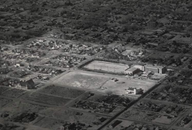
Aerial photograph of Las Vegas, circa 1940s-1950s. Elbert Edwards Photo Collection. UNLV Libraries Special Collections & Archives. Cropping and vignette added to original by The Historic Las Vegas Project.
"With the start of the Hoover Dam project in 1931, Las Vegas began to spread out in all directions. The area around the high school emerged as a significant residential neighborhood. Most of the single-family residences were built between 1928 and the beginning of World War II. The houses featured many different architectural styles, notable Tudor revival, Mission and Ranch. Many of the city's prominent citizens lived in the neighborhood in the 1930s. Starting in the 1980s, many homes were converted to professional offices, while maintaining their architectural and historic character. Although most of the families are gone, the flavor of the neighborhood is very similar to what it was when it began".
(Las Vegas Centennial Commission)
Historic Las Vegas neighborhood dating back to the 1920s.
Listed on the National Register of Historic Places in 1991.
Listed as a U.S Historic District.
Roughly bounded by: East Bridger Avenue, South 9th Street, Gass Avenue, South 6th Street.